
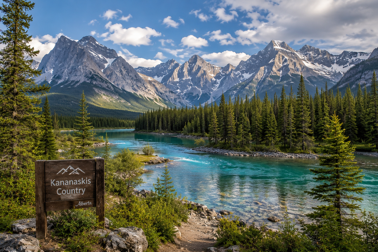
I live in Calgary. And when people ask me where I go to clear my head, breathe mountain air, and feel genuinely small in the best possible way, I always say the same thing: Kananaskis.
Not Banff. Not Lake Louise. Kananaskis.
Banff is magnificent, and I won't argue otherwise. But it can also feel like hiking in an airport terminal during peak season. Kananaskis is different. It is wilder, quieter, and somehow more honest. The trails still reward you with jaw-dropping views of the Rockies, turquoise lakes, and golden larch forests in September, but without the tour bus congestion or the Instagram line-ups.
I want to share the trails that have stopped me in my tracks over the years. Some are well-known to locals but still fly under the radar for visitors. A few are genuinely off the beaten path. All of them are worth every step.
First, the Practical Stuff
You need a Kananaskis Conservation Pass to park at all trailheads in the region. Do not skip this. Parking lots are regularly checked, and the fees support trail maintenance across the whole area. Pick it up online before you go.
Always carry bear spray, make noise on the trail, and travel with a buddy when you can. Bighorn sheep, moose, and grizzly bears are regular residents out here. That is part of the magic, but it also requires you to be prepared.
Cell coverage is minimal in most of K-Country. Download your trail maps offline through AllTrails or Gaia GPS before you leave home.
1. Ptarmigan Cirque — The Alpine Fast-Track
Distance: 6 km return
Elevation gain: ~200 m
Difficulty: Easy to moderate
Trailhead: Highwood Pass parking lot, Highway 40
If you want to reach the alpine quickly without a full-day grind, this is your trail. The trailhead sits at Highwood Pass, which is the highest point in Canada accessible by paved road, so you are already starting at elevation. The trail climbs through subalpine forest and opens into a stunning cirque ringed by jagged peaks.
In early summer, wildflowers carpet the cirque floor. In September, the larches turn gold and the whole basin glows. It is genuinely one of the most rewarding short hikes in Alberta.
A few things to know: it gets cold and windy once you clear the treeline, so pack an extra layer even on warm days. Snow can linger here well into late June. And yes, grizzly bears have been spotted on this trail seasonally, so your bear spray should be clipped and accessible, not buried at the bottom of your pack.
2. Arethusa Cirque — The One That Sneaks Up on You
Distance: ~5 km return
Elevation gain: ~300 m
Difficulty: Moderate
Trailhead: Near Highwood Pass, Highway 40
Most people who drive up to Highwood Pass head straight for Ptarmigan Cirque. Not many notice the sign for Arethusa Cirque just across the road. That is their loss, and quietly your gain.
Arethusa Cirque rewards hikers with a remarkable amount of Rocky Mountain scenery for a short outing. The trail is not as widely recognized as its neighbors, which means the parking area is small and fills up fast, but the cirque itself stays relatively peaceful throughout the day.
Come in late September and you will walk through expansive patches of golden larch trees that frame the base of the mountain cirque in a way that genuinely looks painted. Arrive early. This one is worth it.
3. Rawson Lake and Sarrail Ridge — Two Hikes for the Price of One
Distance: 7 km return to Rawson Lake; 11 km to Sarrail Ridge and back
Elevation gain: ~320 m to Rawson Lake; ~900 m including Sarrail Ridge
Difficulty: Moderate (lake only) to challenging (full ridge)
Trailhead: Upper Kananaskis Lake Day Use Area
This is one of my personal favourites, and for good reason.
The hike to Rawson Lake alone is a beautiful, manageable outing. You follow forested switchbacks and pass a waterfall before ascending to the lake, which sits tucked beneath towering cliffs. The reflection of Mount Sarrail on the water on a calm morning is something I have stopped to photograph probably a dozen times. Many hikers turn around here and go home happy, and that is a perfectly reasonable choice.
But if your legs are willing and the conditions are dry, continuing to Sarrail Ridge is worth every ounce of effort it demands. The final push is steep, relentless, and involves some loose scree that will test your footing. Trekking poles are not optional here; they are genuinely useful. From the ridge, the view over Upper Kananaskis Lake against the surrounding peaks is one of the finest panoramas in the entire region.
Do not attempt the ridge in wet or icy conditions. The informal route is steep enough that a slip carries real consequences. Go on a dry, clear day and give yourself plenty of time.
4. Lillian Lake and Galatea Lakes — The Hike of Many Bridges
Distance: 6.3 km one way to Lillian Lake; additional 2.4 km to Upper Galatea Lake
Elevation gain: ~600 m to Lillian Lake
Difficulty: Moderate
Trailhead: Galatea Day Use Area, Highway 40
There is something deeply satisfying about this trail. You cross the Kananaskis River on a suspension bridge at the start, and then the path follows Galatea Creek up the valley, crossing it again and again on a series of well-built wooden bridges. By the end, I stopped counting after ten.
The creek is beautiful throughout, with clear water rushing over polished rock and spruce trees leaning in from both sides. Around the 3-kilometer mark the trees open up briefly and you get a sweeping look back down the valley, with Mount Kidd standing to the north and Fortress Ridge to the south. Then the forest closes in again and the trail keeps climbing.
Lillian Lake is a gem on its own. It sits at the base of Mount Galatea, peaceful and surrounded by steep walls. There are benches along the shore, a backcountry campground with 17 sites if you want to extend the trip overnight, and enough quiet to make you forget you drove here from a city.
If you have the energy, continue past Lillian Lake another kilometer or so to reach Lower and Upper Galatea Lakes. The path gets narrower and involves some steep sections, but the payoff is three enchanting lakes nested beneath rugged peaks, each one a little more dramatic than the last.
One practical note: this parking lot has had issues with vehicle break-ins. Leave nothing visible in your car before you head out.
5. Pocaterra Ridge — The Ultimate Larch Walk
Distance: 8.4 km out and back
Elevation gain: ~659 m
Difficulty: Challenging
Trailhead: Highwood Pass area, Highway 40
If I had to pick one trail for a clear day in late September, it would be Pocaterra Ridge. The larch display here is among the best anywhere in Alberta. The trees line the trail and fill the slopes below the ridge with gold that catches the afternoon light in a way that genuinely looks surreal.
Even outside larch season, the ridge delivers 360-degree views of rocky mountain peaks and forested valleys that stretch as far as you can see in every direction. This is a challenging hike and involves sustained climbing, but the views from the top justify every step of it.
Start early. This trail sees meaningful traffic on autumn weekends, and the narrow ridge path is more pleasant when you are not queuing.
6. Burstall Pass — The One Worth the Approach
Distance: 14 km return
Elevation gain: ~490 m
Difficulty: Moderate to challenging
Trailhead: Burstall Day Use Area, Smith-Dorrien Trail
Burstall Pass is one of those hikes where the approach through the valley feels almost too easy, and then the views at the pass hit you all at once.
The trail starts flat, crossing open floodplains and winding through forest before the climb to the pass begins. In autumn, you can look back down into a valley cradled between rocky peaks and bluffs, where the larch trees glow yellow below you in a scene that looks like it belongs in a nature documentary. Experienced hikers with energy to spare can scramble up Snow Peak for one of the best panoramic views in the entire Rockies.
This is one of the more accessible big-scenery hikes in K-Country. It is appropriate for intermediate hikers and a genuinely satisfying full-day outing.
7. The Hidden Suspension Bridge Near Smith-Dorrien — The Five-Minute Reward
Distance: 1.5 km return
Elevation gain: Minimal
Difficulty: Easy
Trailhead: Along Smith-Dorrien Trail (use AllTrails to find the exact pullout)
This one is short enough to feel almost like cheating, but I include it because it genuinely qualifies as a hidden gem. A short, gentle walk through the trees leads to a suspension bridge tucked into the forest with mountain views and almost no one around.
It is the kind of spot you stumble onto and feel strangely lucky to have found. If you are driving through the area and want to stretch your legs without committing to a full hike, this is an honest thirty-minute detour that punches well above its weight.
Finding the trailhead can be a bit tricky. Pull up the AllTrails map before you leave home and note the rough coordinates.
A Few Tips Before You Go
Go early. Almost every trail on this list has a small parking lot relative to its popularity. On summer and fall weekends, lots fill by mid-morning. Early arrivals get the best light anyway.
Bring layers. Temperature drops fast once you gain elevation or when clouds roll in. A light windproof jacket is always worth the weight.
September is magic. If you only go to Kananaskis once a year, time it for late September if you can. The larch season is brief and genuinely one of the most beautiful natural events Alberta has to offer.
Tell someone where you are going. Cell coverage is minimal out here. It takes thirty seconds to send a text to a family member before you leave the parking lot. Do it every time.
Carry bear spra, and know how to use it. Every person in your group needs their own canister, clipped and accessible, not buried in a pack. Check the expiry date before you leave home, because an expired can is not reliable when you need it most. K-Country is bear country in the truest sense. Grizzlies and black bears live here year-round. When we hike these trails, we are walking through t
I have been hiking trails in Kananaskis for years now and I am still finding corners of it that feel brand new. That is the honest magic of this place. It rewards patience and rewards people who are willing to go just a little further than the next person.
If you have a favourite trail out here that I missed, I would genuinely love to hear about it.The best directions in K-Country still travel by word of mouth, born from unplanned wandering with respect and a deep awareness of the soul of the forest.